flowchart LR
1[Is it public?] --YES-->
2[Is it appropriate\nfor OSM?] --YES-->
3[Is there any reason to\nkeep an internal copy?] --NO-->
4[Is OSM as good\nor better?] --YES-->
5[DELETE]

3 --YES--> A[Figure out periodic\nedits / conflation] --> B
4 <--NO--> B[Edit OSM!]
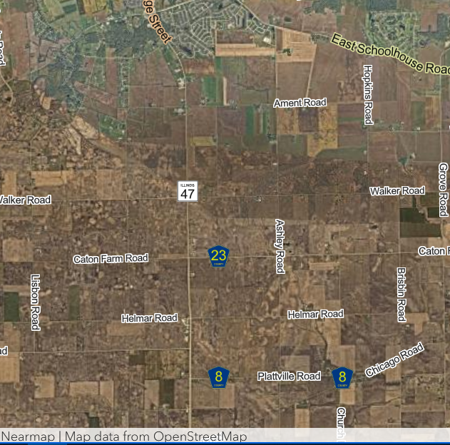
Kendall County on OSM
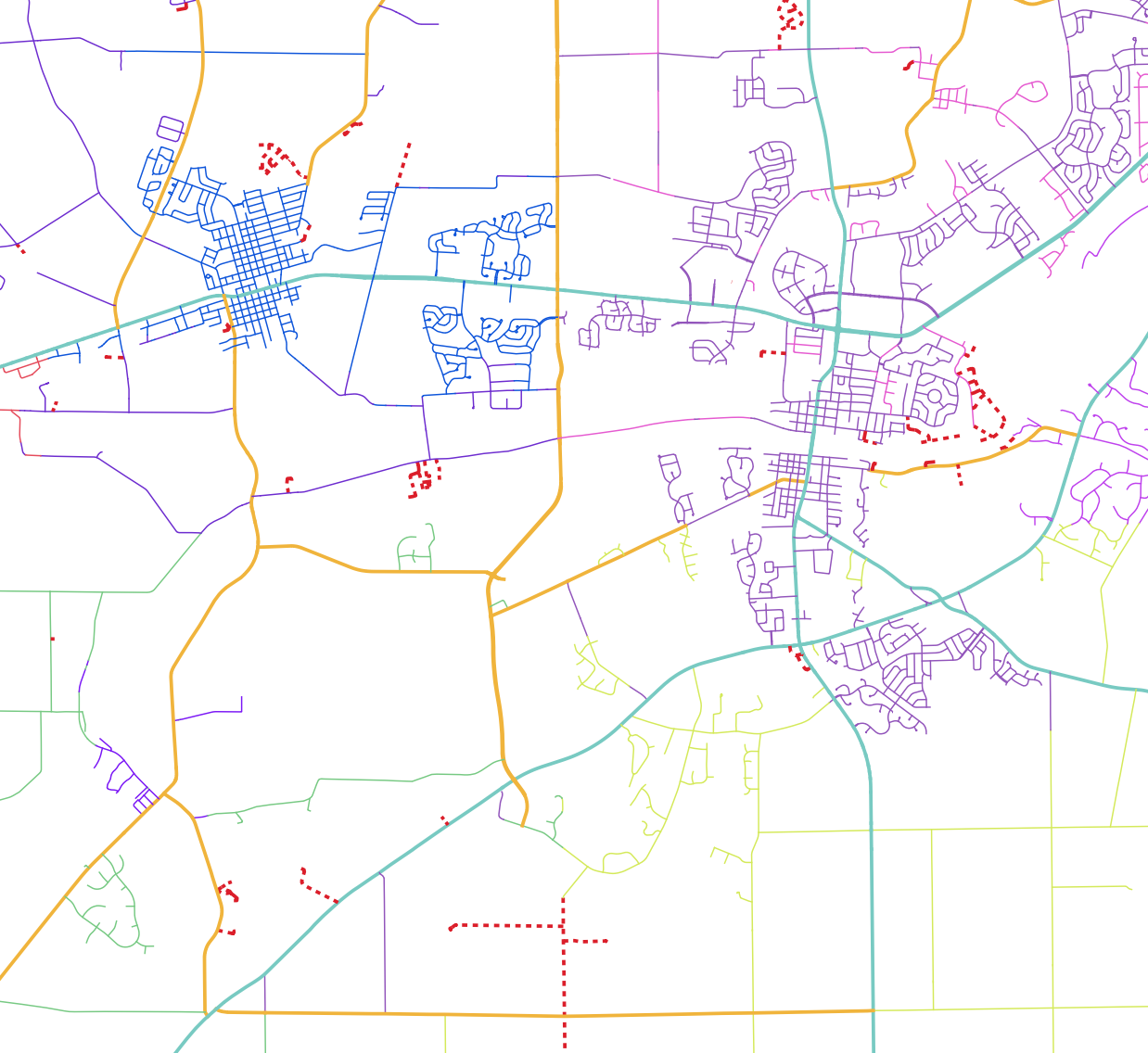
Basemaps, again
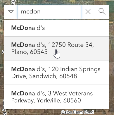
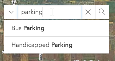
Point of Interest Locator
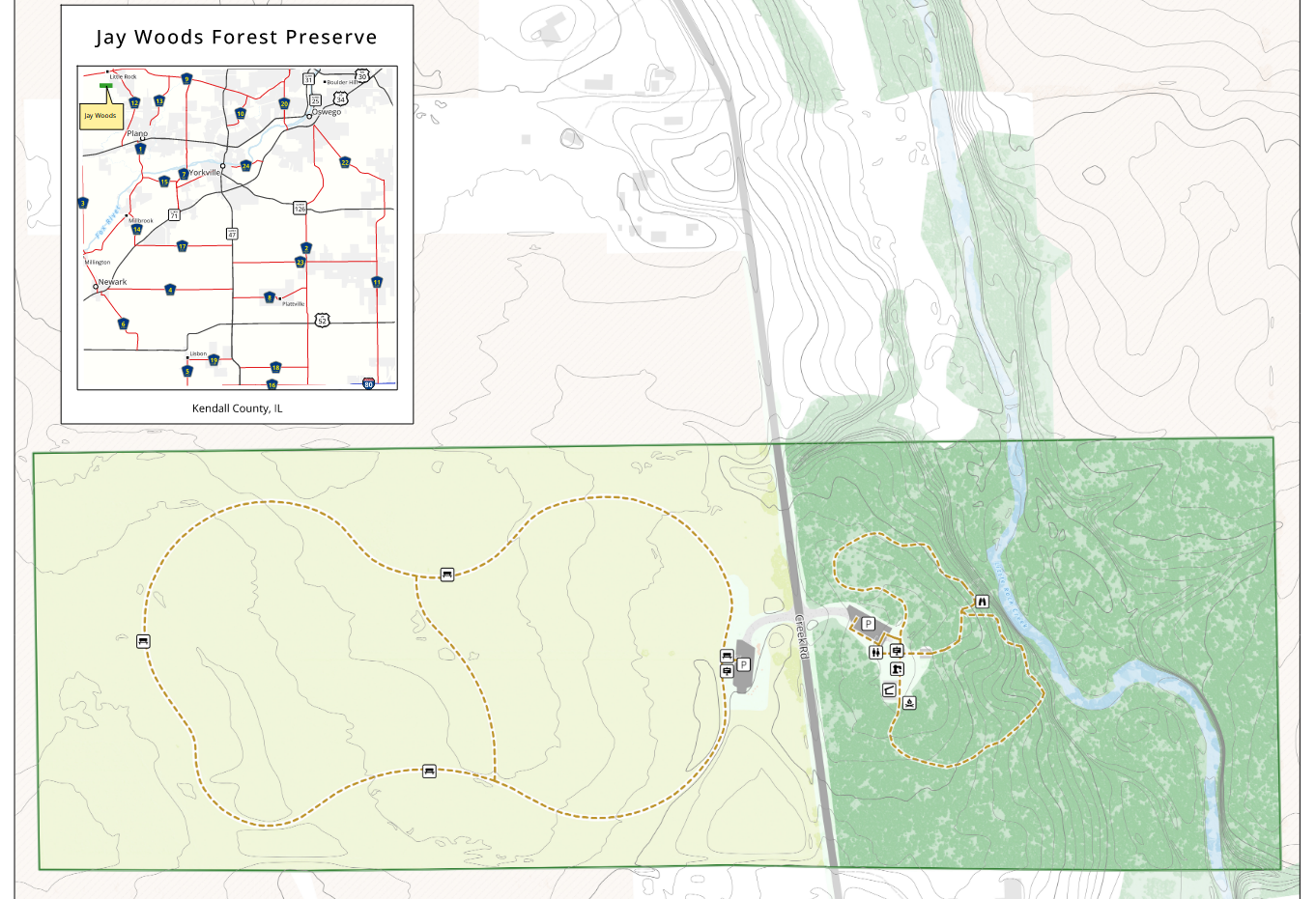
Forest Preserves
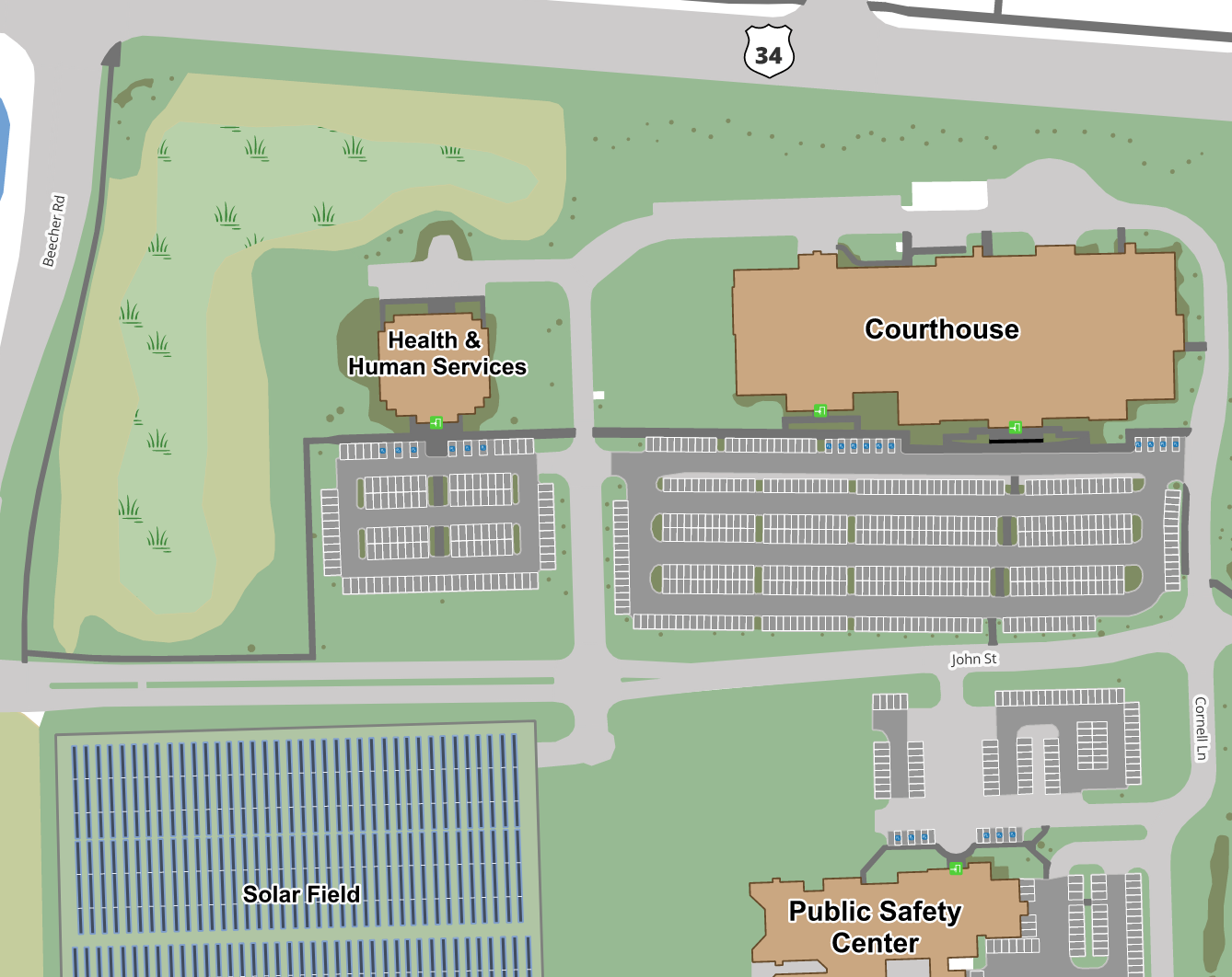
Campus Maps
As much information as possible!
- operators (pictured)
- speed limits
- traffic signals and signs
- classification
- lanes
- surfaces
- areas
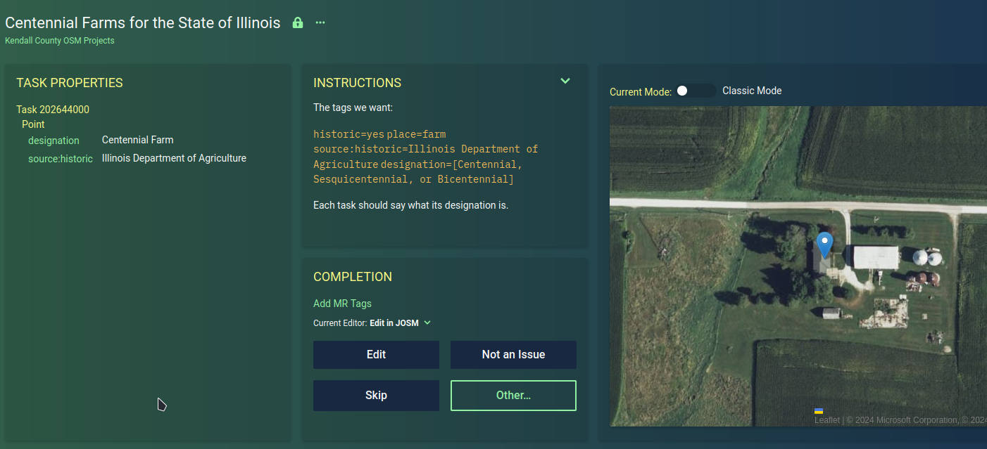
Centennial Farms


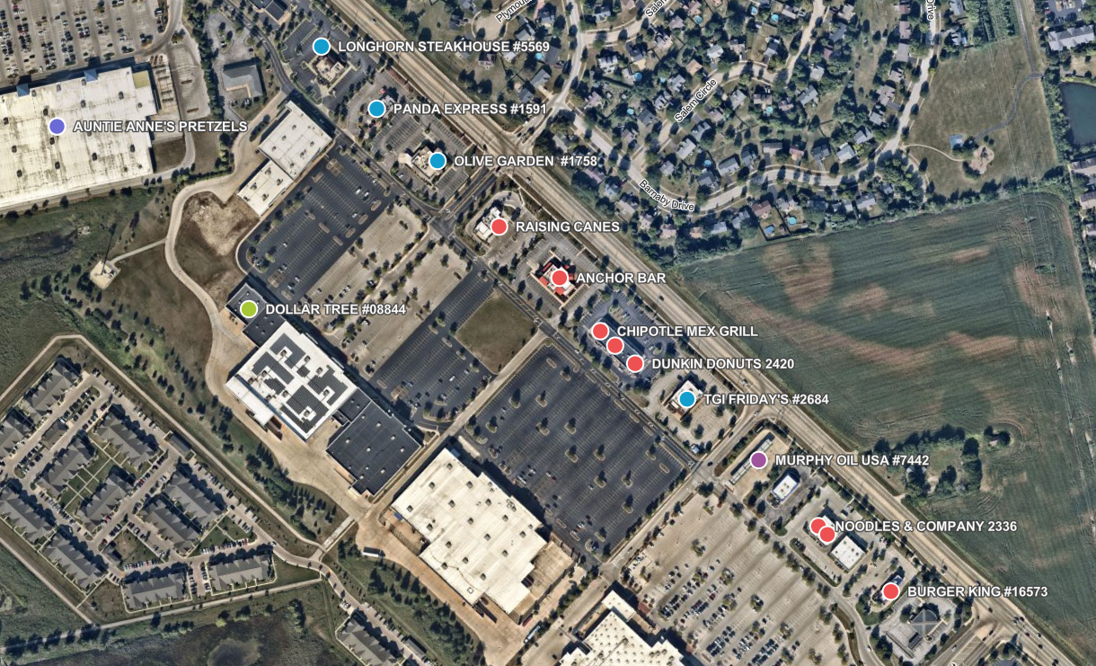
Restaurants POI Updating
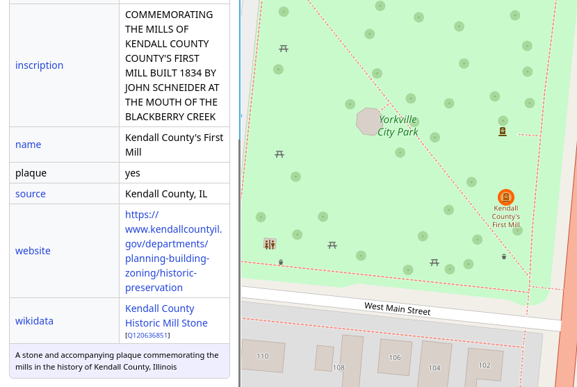
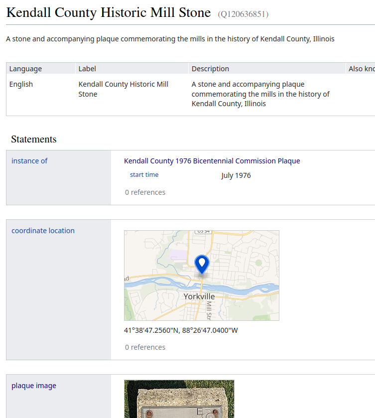
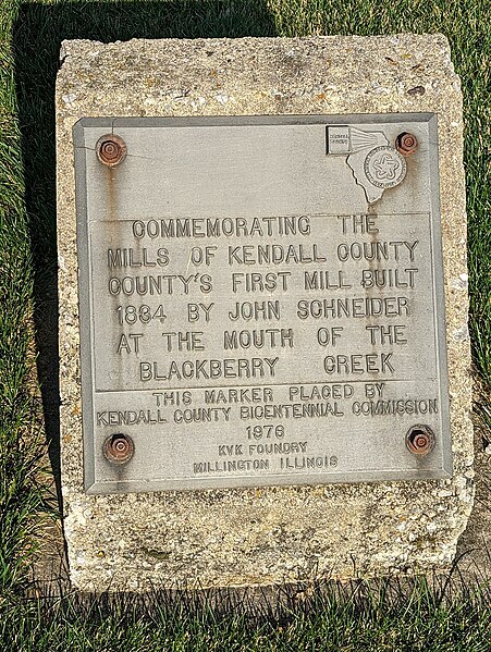
Historic Plaques
Example: Historic Mill Stone Plaque
CAMA Data
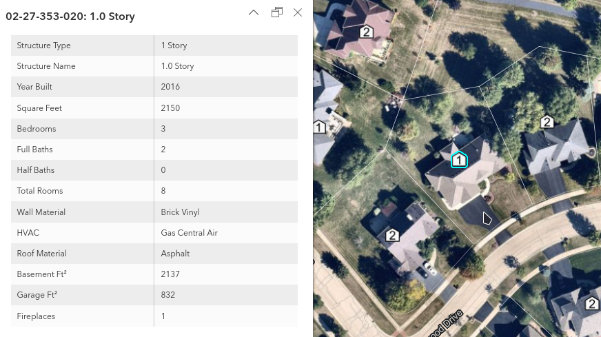
- Obvious stuff
- Year built
- Building Levels
- Wall and roof materials
- Maybe? 1
- Room types / counts
- Square footage
Asset Inventories
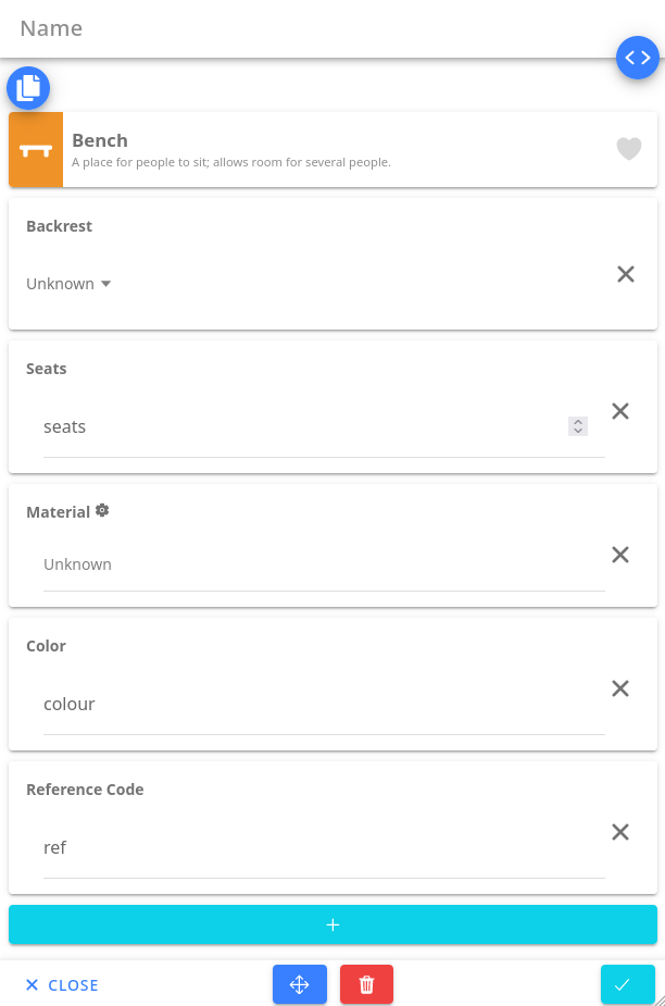
- OSM Go +
survey_datetag - Routine check of quality, functionality
- Internal
ref - Join to internal asset DB on ref tag?