Let’s Read a Legal!
Legal descriptions: what does all this stuff even mean?
Who’s this guy, anyway?
- I once read an old binder from someone else’s course on property assessments
- I’ve read lots of legals the past half a decade
- I am not professionally trained or certified
Easy Mode: Lots and Blocks
Characteristics
- A lot number
- A subdivision name
- Maybe a block number? But that’s kind of old fashioned
Example
LOT 48 IN DEER CROSSING SUBDIVISION UNIT 1, BEING A PART OF THE SOUTHEAST QUARTER OF SECTION 26, TOWNSHIP 36 NORTH, RANGE 8 EAST OF THE THIRD PRINCIPAL MERIDIAN, ACCORDING TO THE PLAT RECORDED AUGUST 26, 2010 AS DOCUMENT NUMBER 201000014876, IN THE CITY OF JOLIET, IN KENDALL COUNTY, ILLINOIS
Look Out!
Subdivision descriptions often come with details:
- Document number
- Section, Township, Range
Pedant Warning
These must be correct!
Does it get weirder?
Nope!
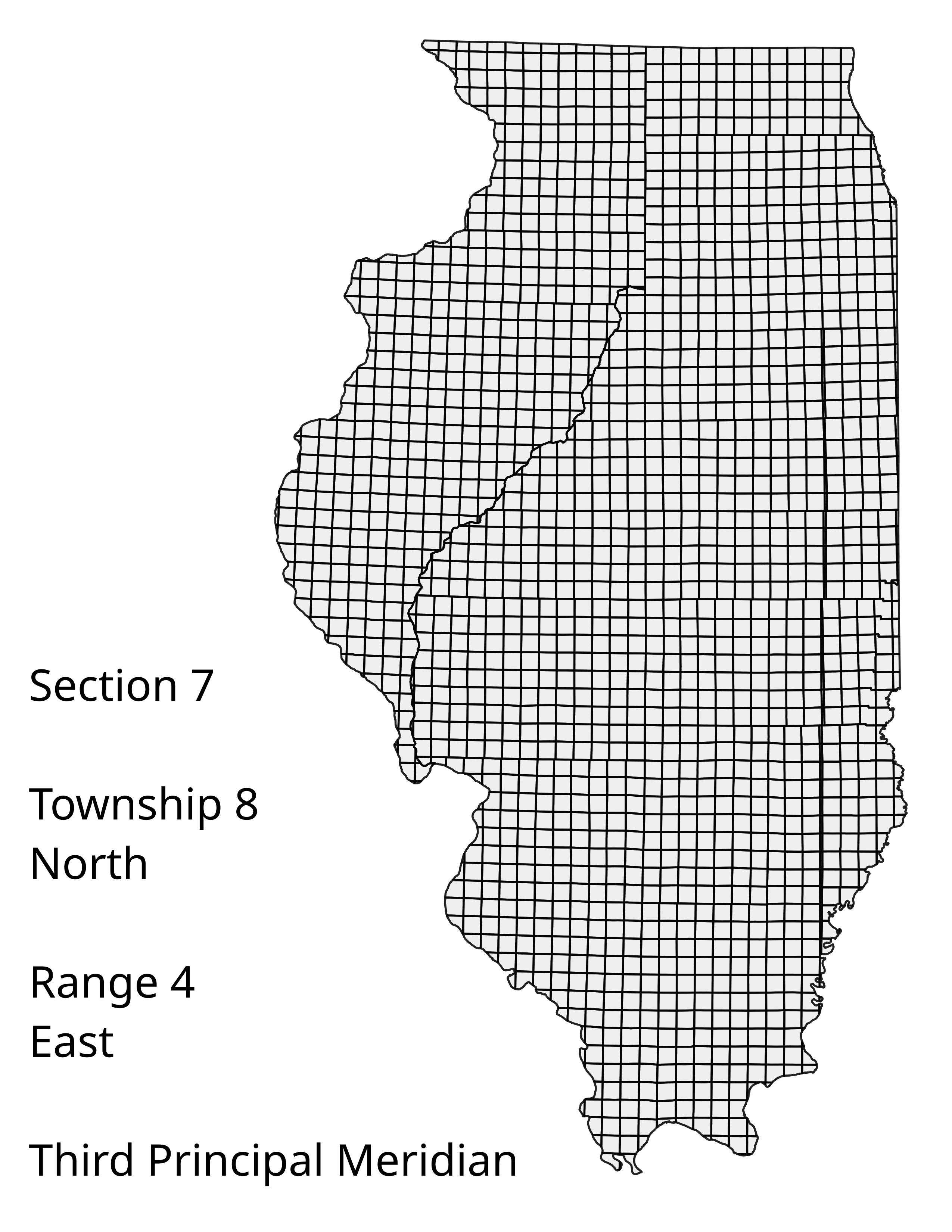
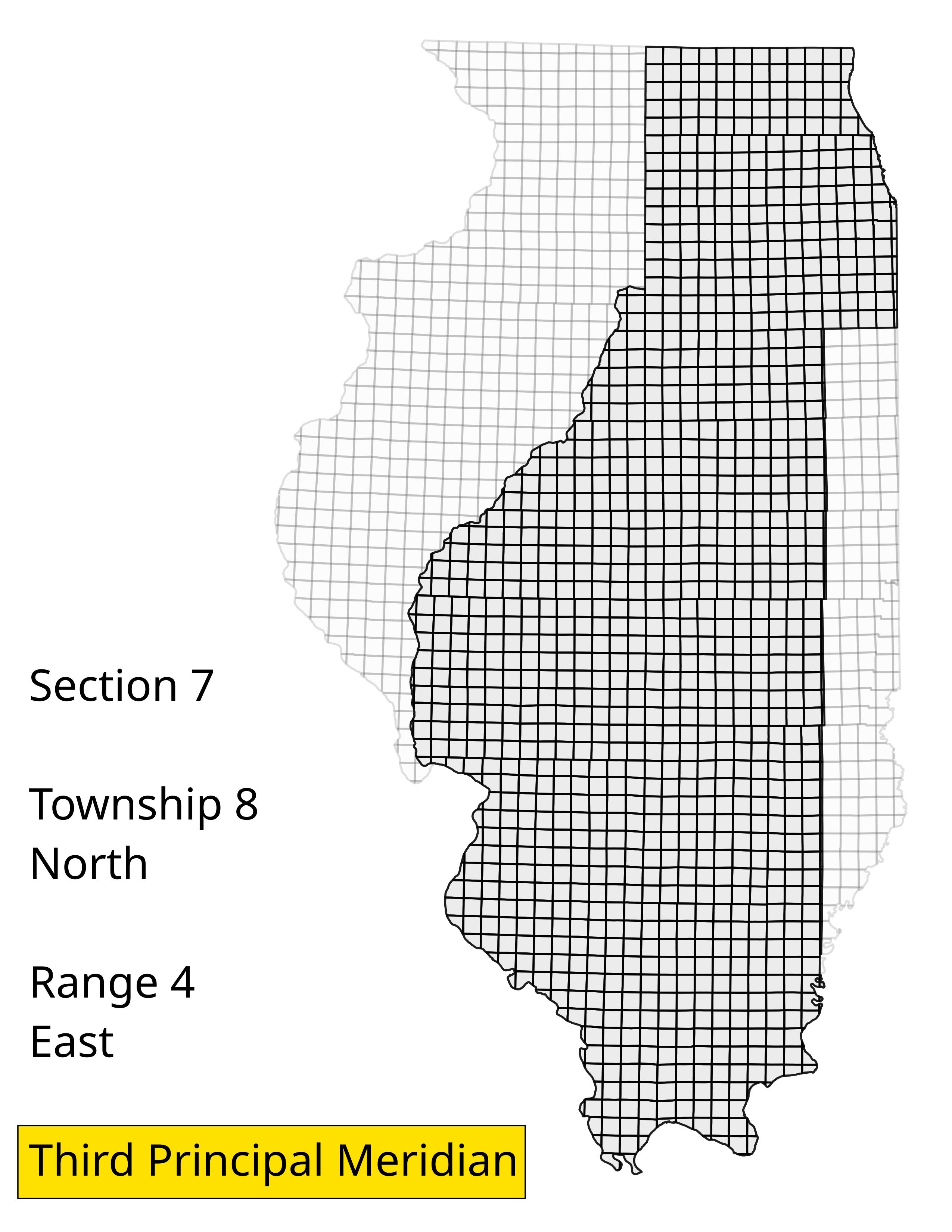
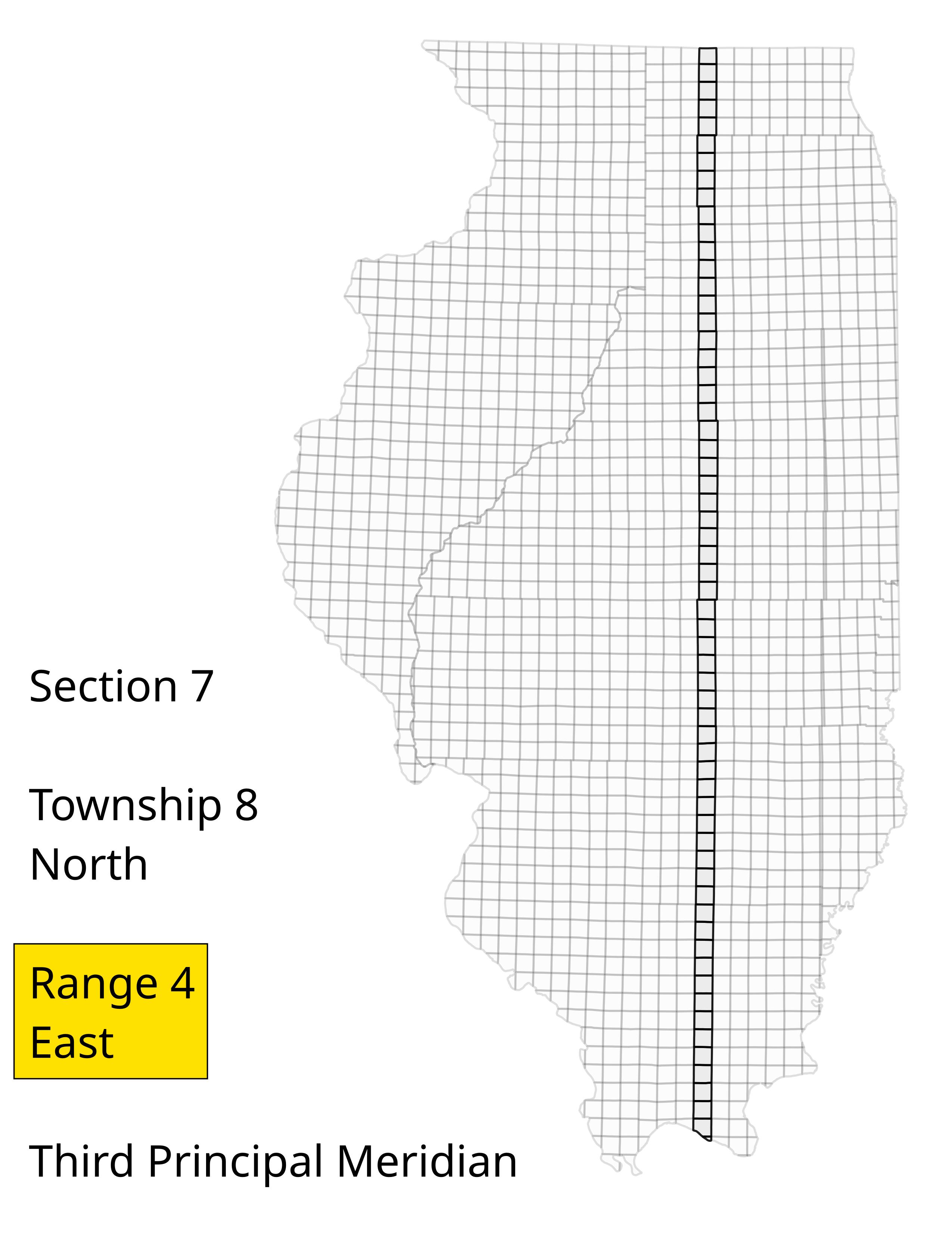
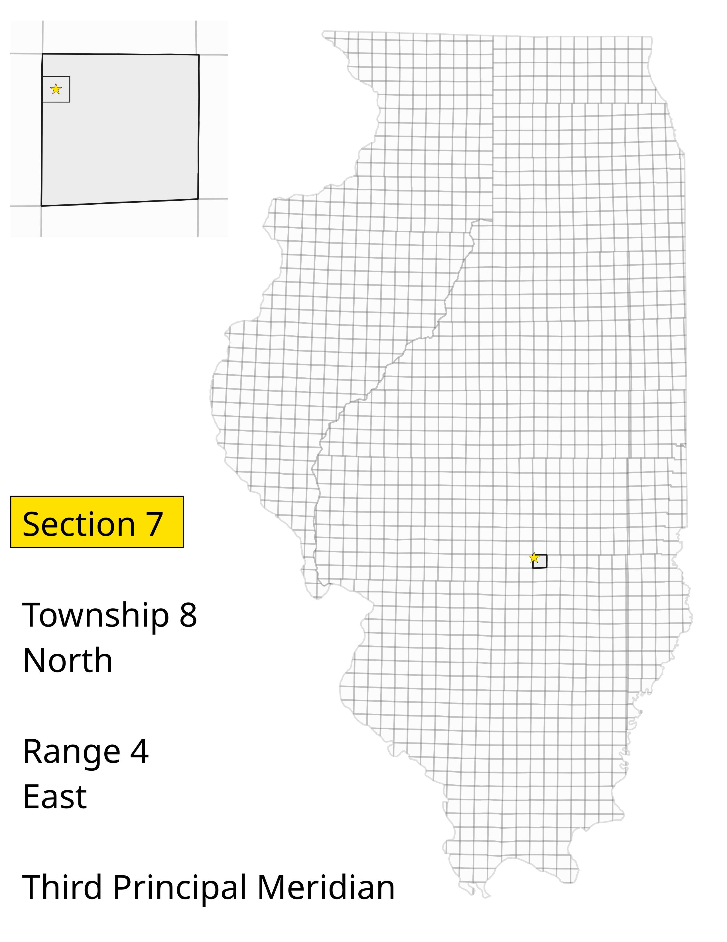
Simple, but Funky: Rectangular Surveys
Characteristics
- Follows PLSS grid features
- Often large areas
Example
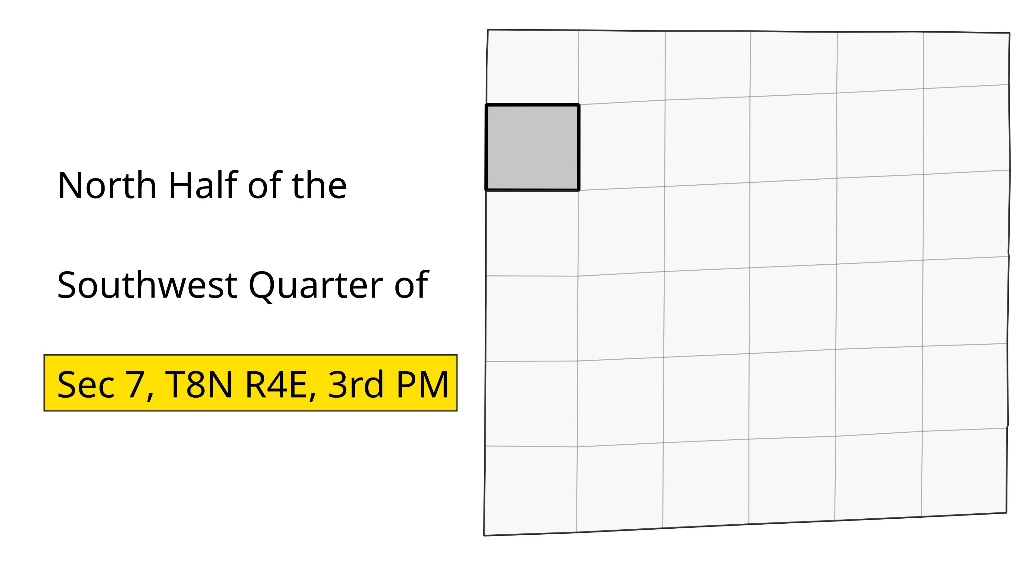
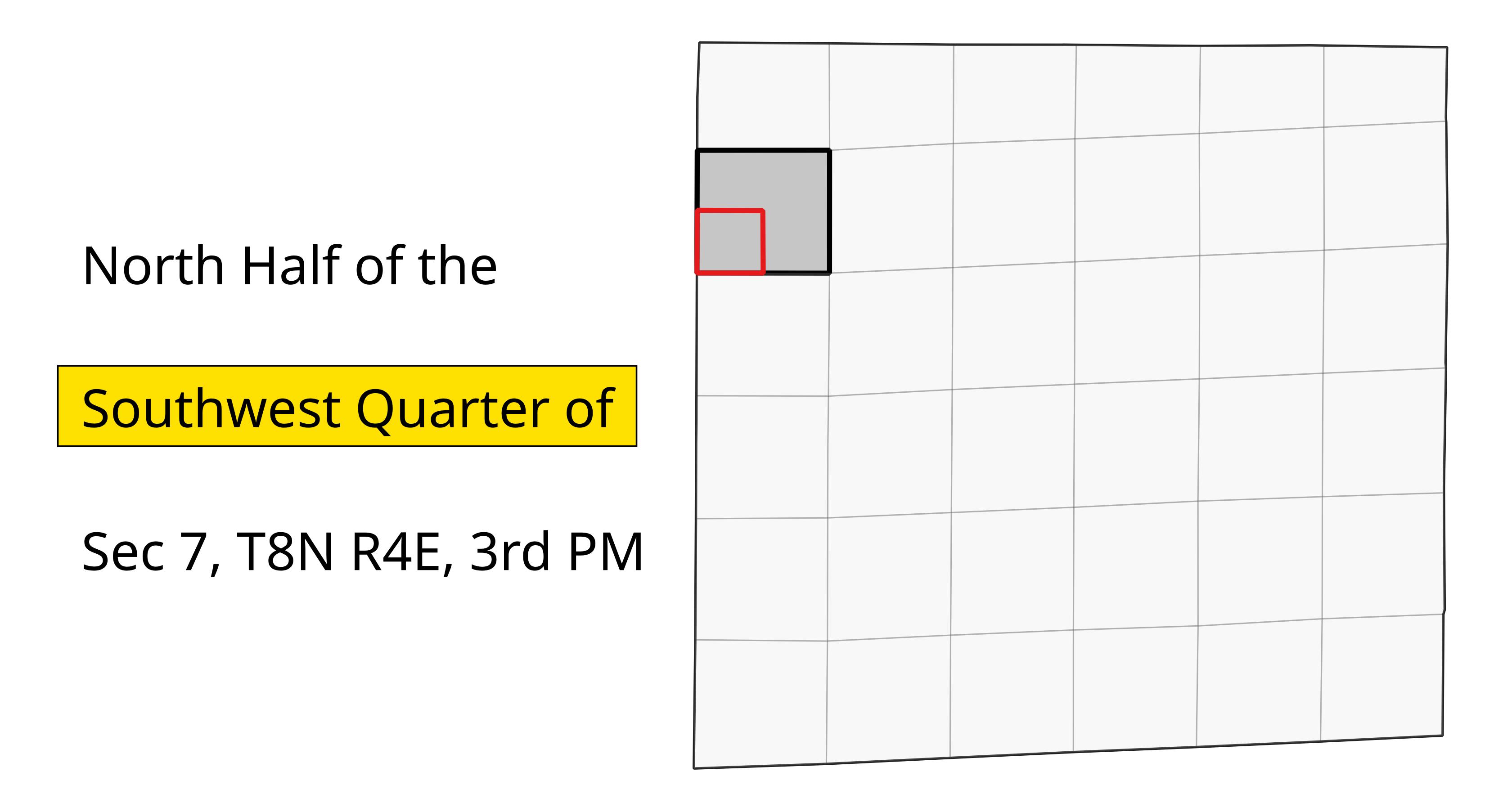
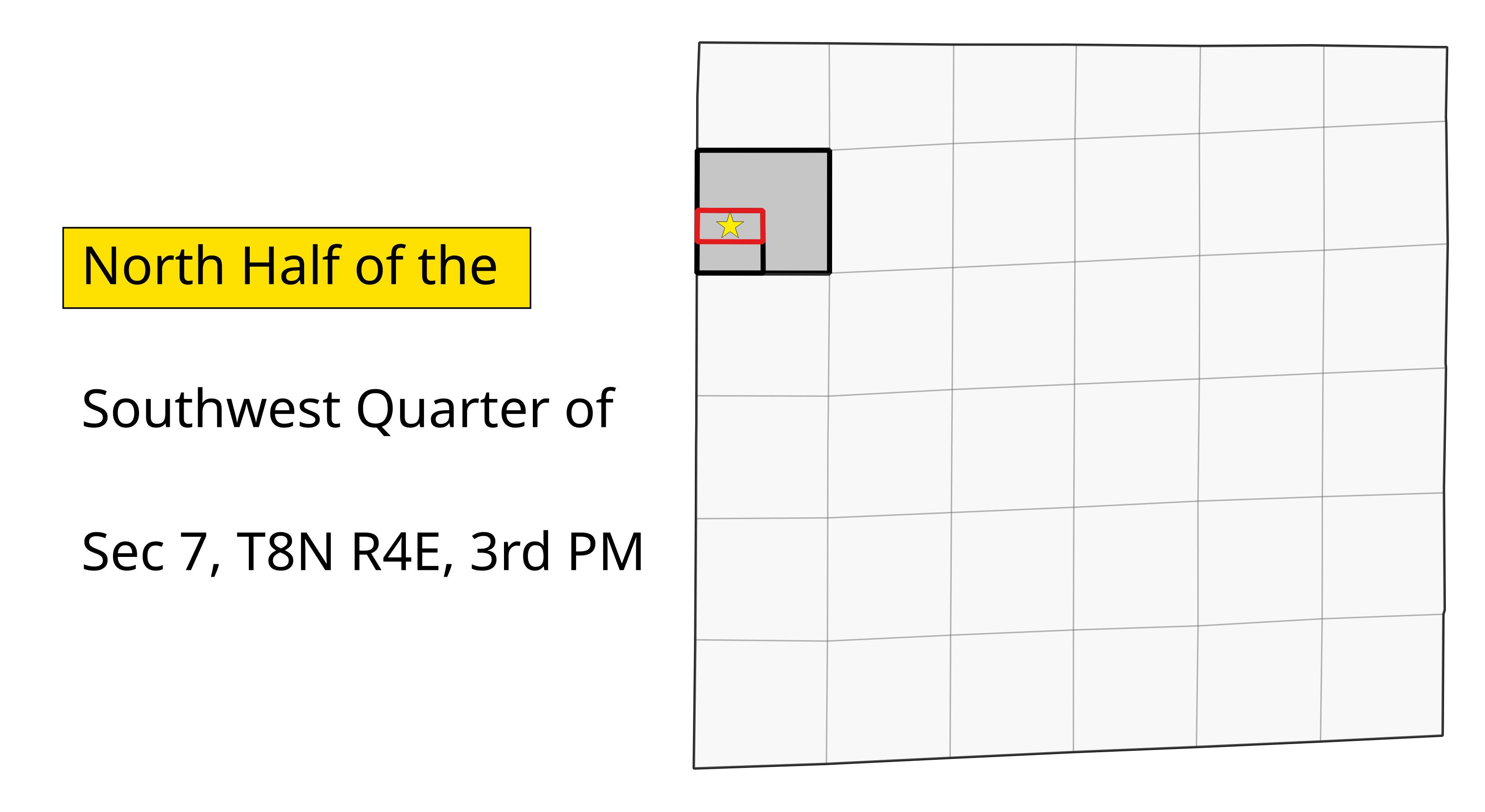
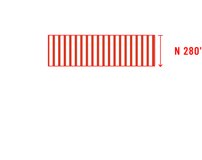
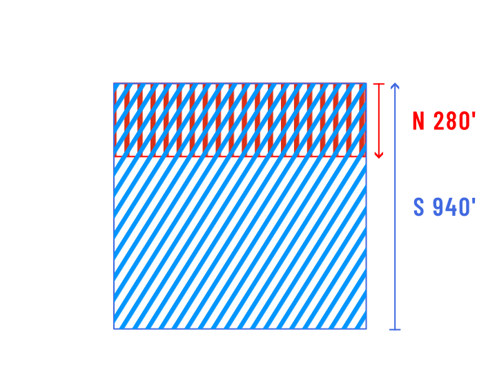
N ½ of SW ¼ of Section 7, Township 8 N Range 4 E, Third Principal Meridian
Look Out!
It’s probably easier to do these if you start at the end and work backwards.
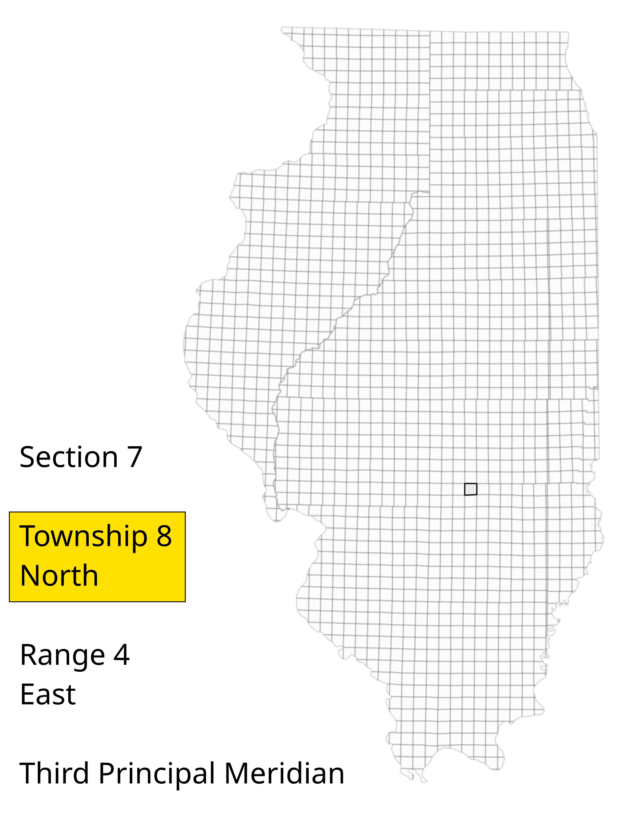
Divisions
Once you get down to the section, you use the same PLSS grid to identify the smaller divisions, if any.
Does it get weirder?
Yes.
But it’s still manageable!
Buffered Portions
For rectangular parcels smaller than a PLSS feature, you might see “buffered” portions, like:
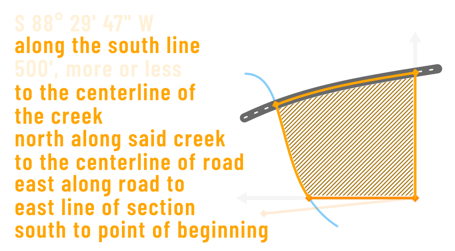
The East 500 feet of the NW ¼ of…
The South 250 feet of the West 700 feet of of the NE ¼ of…


Metes and Bounds
“What fresh hell can this be?”
– Dorothy Parker
The Pieces
- Preamble: Section, Township, Range, etc
- Body: The sequence of boundary lines
- Clauses: Exceptions and other qualifying statements
Example: Nice and Clear
Preamble
LOT 308 UNIT 1 (1135 HAWK HOLLOW DRIVE)
THE NORTHERLY 31.08 FEET OF LOT 308 IN RAINTREE VILLAGE, UNIT FOUR 1ST RESUBDIVISION, BEING A RESUBDIVISION IN PART OF THE SOUTHWEST QUARTER OF SECTION 3 AND PART OF THE NORTHWEST QUARTER OF SECTION 10, ALL IN TOWNSHIP 36 NORTH, RANGE 7 EAST OF THE THIRD PRINCIPAL MERIDIAN, IN THE UNITED CITY OF YORKVILLE, KENDALL COUNTY, ILLINOIS, PURSUANT TO THE PLAT THEREOF RECORDED IN KENDALL COUNTY, ILLINOIS ON MARCH 27, 2020, AS DOCUMENT 202000004800 (“RAINTREE VILLAGE UNIT 4 1ST RESUBDIVISION”). BEING DESCRIBED BY METES AND BOUNDS AS FOLLOWS:
Example: Nice and Clear
Body
BEGINNING AT THE NORTHWEST CORNER OF SAID LOT; THENCE NORTH 88 DEGREES 31 MINUTES 17 SECONDS EAST ALONG THE NORTH LINE OF SAID LOT A DISTANCE OF 76.00 FEET TO THE NORTHEAST CORNER THEREOF; THENCE SOUTH 01 DEGREES 28 MINUTES 43 SECONDS EAST ALONG THE EAST LINE OF SAID LOT A DISTANCE OF 31.08 FEET; THENCE SOUTH 88 DEGREES 31 MINUTES 17 SECONDS WEST 76.00 FEET TO THE WEST LINE OF SAID LOT; THENCE NORTH 01 DEGREES 28 MINUTES 43 SECONDS WEST ALONG SAID WEST LINE 31.08 FEET TO THE POINT OF BEGINNING.
CONTAINING 2362 SQUARE FEET MORE OR LESS.
Isolate the Important Details
- Lot 308, Raintree Unit Four 1st Resub
- Begin @ NW Corner
| Bearing | Distance |
|---|---|
| N88-31-17E | 76.00 |
| S01-28-43E | 31.08 |
| S88-31-17W | 76.00 |
| N01-28-43W | 31.08 |
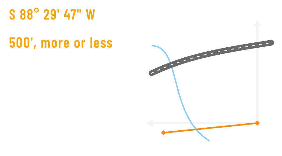
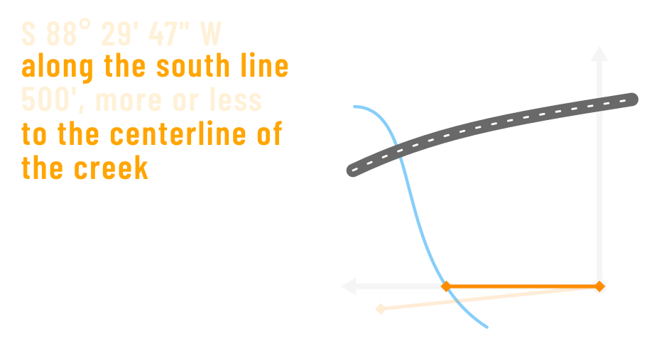
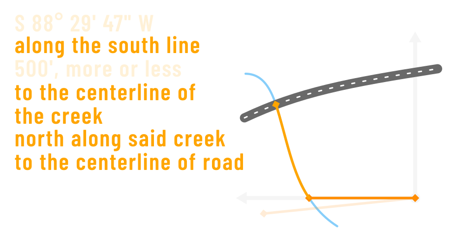
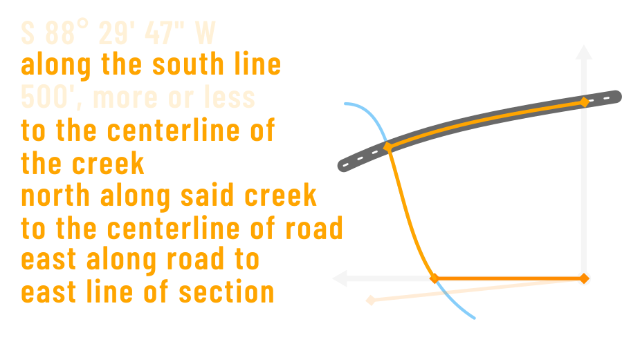
Draw it Out

Clauses: Exceptions
[Some description] except any part thereof lying westerly of Aux Sable Creek.

Order of Operations!


Example: Long and Complex
PARCEL 1: That part of Sections 3 and 4, Township 36 North, Range 7 East and part of Sections 33 and 34, Township 37 North, Range 7 East of the Third Principal Meridian, in Kendall County, described as follows: Beginning at the Southwest corner of said Section 34; thence North 89 degrees 30 minutes 19 seconds East 1337.80 feet along the South line of said section; thence North 08 degrees 39 minutes 48 seconds West 933.03 feet; thence North 83 degrees 09 minutes 07 seconds East 1100.09 feet; thence South 36 degrees 42 minutes 15 seconds East 1372.74 feet; thence South 45 degrees 07 minutes 49 seconds East 147.60 feet; thence South 19 degrees 44 minutes 49 seconds East 1426.44 feet to the North right-of-way line of Route 71; thence South 59 degrees 59 minutes 12 seconds West 1626.67 feet along said North Right of Way line to a point of curvature; thence Southwesterly along said Right-of-way also being the arc of said curve, concave Northwesterly, having a radius of 11409.20 feet, 1175.81 feet to the Northerly right-of-way per quit claim deed recorded June 7, 2006 as document number 200600016923; Thence South 73 degrees 42 minutes 35 seconds West 75.30 feet to a Point of Curve; thence Westerly 298.44 feet along the arc of said curve, concave Northerly, having a radius of 11419.02 feet and a chord bearing of South 67 Degrees 00 minutes 47 seconds West to a point; thence South 76 degrees 35 Minutes 30 seconds West 100.54 feet to a point of curve: thence Westerly 198.68 feet along the arc of said curve, concave Northerly, having a radius of 11404.02 feet and a chord bearing of South 68 degrees 45 minutes 36 Seconds West to a point; thence North 82 degrees 02 minutes 51 seconds West 69.24 feet; thence North 35 degrees 14 minutes 31 seconds West 52.98 feet to a point of curve; thence Northerly 585.25 feet along the arc of said curve, concave Southerly, having a radius of 995.00 feet and a chord bearing of North 52 degrees 05 minutes 31 seconds West to a point; thence North 77 degrees 23 minutes 03 seconds West 106.86 feet to a point of curve; Thence Westerly 241.95 feet along the arc of said curve, concave Southerly, having a radius of 985.00 feet and a chord bearing of North 82 Degrees 08 minutes 24 seconds West to a point; thence North 89 degrees 10 Minutes 36 seconds West 271.56 feet; thence North 79 degrees 13 minutes 51 Seconds West 86.85 feet; thence North 85 degrees 39 minutes 05 seconds West 105.78 feet; thence North 79 degrees 16 minutes 56 seconds West 234.01 Feet to a point of curve; thence Northerly 244.55 feet along the arc of said Curve, concave Northerly, having a radius of 880.00 feet and a chord Bearing of North 58 degrees 45 minutes 42 seconds West to a point; thence North 50 degrees 48 minutes 03 seconds West 141.56 feet; thence North 62 Degrees 06 minutes 44 seconds West 50.99 feet to the existing Easterly Right-of-way line of route 126; thence North 50 degrees 47 minutes 53 Seconds West 104.63 feet to a point of curve; thence Northwesterly along said right-of-way line also being the arc of said curve, concave Southwesterly, .having a radius of 8021.63 feet and a chord bearing of North 54 degrees 21 minutes 20 seconds West, a distance of 1290.48 feet; Thence North 00 degrees 12 minutes 15 seconds East 275.41 feet; thence North 44 degrees 18 minutes 35 seconds West 279.54 feet to the West line of The Northwest % of said section 4; thence North 00 degrees 02 minutes 35 Seconds East 957.22 feet along said West line to the North 1/4 corner of said Section 4; thence North 89 degrees 10 minutes 25 seconds East 347.89 feet Along the North line of said section 4; thence North 00 degrees 16 minutes 19 seconds East 1555.92 feet to the South line of the Woodlands subdivision; Thence along. The South and East line of said subdivision the following 6 Courses; 1. South 85 degrees 55 minutes 36 seconds East 234.74 feet; 2. South 86 degrees 55 minutes 36 seconds East 400.00 feet; 3. North 89 degrees 04 Minutes 24 seconds East 225.00 feet; 4. North 87 degrees 04 minutes 24 seconds East 150.00 feet; 5. North 88 degrees 04 minutes 24 seconds East 160.00 feet; 6. North 09 degrees 34 minutes 24 seconds East 646.13 to the Northeast corner of said subdivision; thence North 09 degrees 36 minutes 12 seconds East 295.95 feet to the Southerly right-of-way line of Van Emmon road; thence Northeasterly along said right-of-way being a curve, concave Northwest, having a radius of 1646.02 and a chord bearing of North 68 degrees 12 minutes 43 seconds East, a distance of 91.34 feet to a point of curve; thence Northeasterly along said curve, concave Southeasterly. Having a radius of 1649.96 feet and a chord bearing of North 69 degrees 47 minutes 52 seconds East, a distance of 178.41 feet along said Right-of way line; thence South 00 degrees 51 minutes 01 seconds West 2536.84 feet to the South line of said section 33; thence South 89 degrees 10 Minutes 25 seconds East 742.23 feet along said South line to said point of Beginning.
PARCEL 2: That part of the Southwest quarter of section 3 township 36 North, range 7 East of the third principal meridian, in Kendall county, described as follows: commencing at the Northwest corner of the Southwest quarter of said section; thence South 00 degrees 10 minutes 34 seconds East 66.39 feet for a point of beginning; thence 535.34 feet along the arc of a curve, Concave Southerly, having a radius of 870.00 feet and a chord bearing of South 52 degrees 52 minutes 11 seconds East to a point; thence South 04 Degrees 00 minutes 28 seconds East 38.57 feet; thence South 45 degrees 00 Minutes 02 seconds West 68.49 feet to a point of curve; thence Westerly 151.94 feet along the arc of said curve, concave Northerly, having a radius of 11419.02 and a chord bearing of South 70 degrees 59 minutes 17 seconds West. To a point of curvature; thence South 71 degrees 22 minutes 09 seconds West 142.84 feet; thence South 86 degrees 34 minutes 47 seconds West 93.98 feet to a point on the West line of said quarter section; thence North 00 degrees 10 minutes 34 seconds West 505.72 feet along said West Line to said point of beginning, in Kendall County, Illinois.
Excluding from the above said PARCEL 1 and PARCEL 2, the following PARCEL 3 and PARCEL 4:
PARCEL 3: Part of the Southwest Quarter of Section 3, Township 36 North, Range 7 East of the Third Principal Meridian, described as follows with bearings and distances based upon the Illinois State Plane Coordinate System, (Grid) East Zone (NAD-83, 2007 adj) Commencing at the West quarter corner of said Section 3, thence South 01 degree 35 minutes 30 seconds East 572.08 feet along the west line of said southwest quarter section to the northerly right of way line of old Illinois Route 126, thence North 85 degrees 09 minutes 51 seconds East 17.99 feet along said right of way line to the point of beginning, thence North 69 degrees 55 minutes 19 seconds East 139.22 feet, thence North 77 degrees 17 minutes 47 seconds East 77.91 feet, thence northeasterly 172.72 feet along a 11,409.05 foot radius curve to the left whose chord bears North 69 degrees 29 minutes 18 seconds East 172.71 feet to the northwesterly right of way line of Illinois Route 71, thence South 43 degrees 33 minutes 14 seconds West 23.18 feet along said right of way line, thence southwesterly 151.94 feet along said right of way line a 11,419.05 foot radius curve to the right whose chord bears South 69 degrees 32 minutes 27 seconds West 151.94 feet, thence South 69 degree 55 minutes 19 seconds West 143.09 feet along said right of way line, thence South 85 degrees 09 minutes 51 seconds West 76.08 feet along said right of way line to the point of beginning, containing 0.111 acre, more or less, situated in the Township of Kendall, State of Illinois.
PARCEL 4: Part of Section 3, Township 36 North, Range 7 East of the Third Principal Meridian, described as follows with bearings and distances based upon the Illinois State Plane Coordinate System, (Grid) East Zone (NAD-83, 2007 adj) Commencing at the northwest corner of said southwest quarter of said Section 3, thence North 88 degrees 06 minutes 02 seconds East 159.28 feet along the north line of said southwest quarter of Section 3 to the northeast right of way line of Illinois Route 126, thence southeasterly 484.52 feet along said right of way line along a 995.00 feet radius curve to the right whose chord bears South 50 degrees 38 minutes 21 seconds East 479.75 feet, thence South 36 degrees 41 minutes 20 seconds East 19.96 feet along said right of way line to the Point of Beginning, thence North 87 degrees 40 minutes 05 seconds East 147.21 feet, thence northeasterly 1,61.7.2 feet along a 11,389.05 foot radius curve to the left whose chord bears North 63 degrees 23 minutes 41 seconds East 1,615.86 feet, thence North 57 degrees 04 minutes 03 seconds East 152.82 feet, thence North 58 degrees 33 minutes 29 seconds East 246.02 feet, thence North 64 degrees 16 minutes 09 seconds East 200.98 feet to the east line of the northwest quarter of section 3, thence North 58 degrees 33 minutes 29 seconds East 50.01 feet, thence South 31 degrees 26 minutes 31 seconds East 25.00 feet to the existing northwesterly right of way line of Illinois Route 71, thence South 58 degrees 33 minutes 29 seconds West 496.02 feet along said existing right of way line to the point of curvature of a 11,429.05 foot radius curve to the right, thence southwesterly 1,173.84 feet along said right of way line along said curve whose chord bears South 61 degrees 30 minutes 02 seconds West 1,173.32 feet, thence South 72 degrees 15 minutes 39 seconds West 75.31 feet along said existing right of way line, thence south 65 degrees 33 minutes 57 seconds West 298.42 feet along said existing right of way line, thence South 75 degrees 08 minutes 41 seconds West 100.54 feet along said existing right of way line, thence South 67 degrees 18 minutes 46 seconds West 198.69 feet along said existing right of way line, thence North 83 degrees 30 minutes 00 seconds West 69.24 feet along said existing right of way line, thence North 36 degrees 41 minutes 20 seconds West 33.02 feet along the northeasterly right of way one of Illinois Route 126 to the Point of Beginning, containing 1.976 acres, more or less, situated in the County of Kendall, State of Illinois.
Just when you thought you understood…
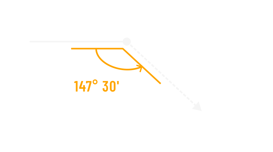
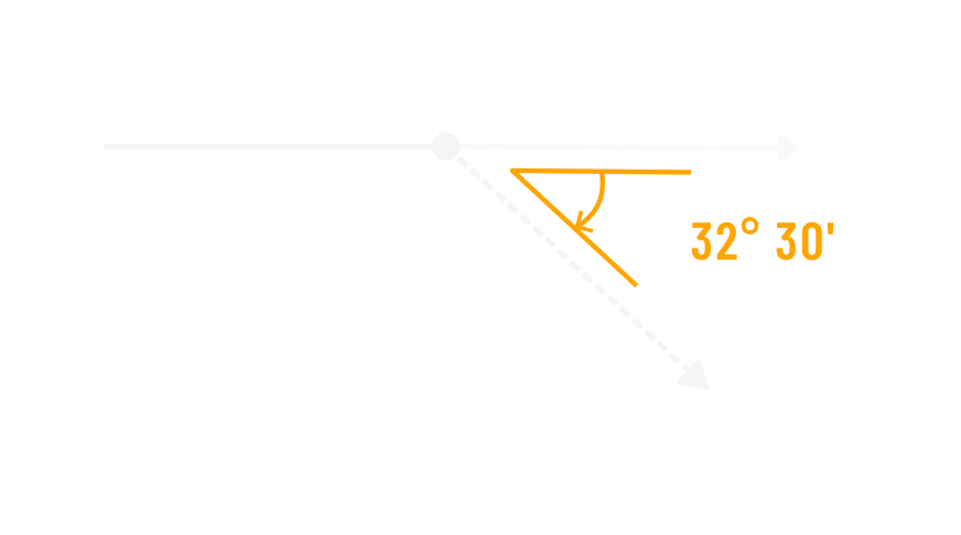
Contextual Calls
Deflection: Backsight
…forming an angle of 147° 30’ from the previous course,
measured counter-clockwise therefrom
Deflection: Prolongation
…forming an angle of 32° 30’ from the prolongation of the previous course,
measured clockwise therefrom
Latent Ambiguity
AKA “forensic mapping”
Present inability to find reference features does not invalidate the description.
Questions?